MAPS ETC!!!
Austin's Atlas aims to be an archive of all things related to Austin maps as well as Austin's sense of place. What you'll find below relates to the crowdsourced atlas, the maps we make in house, as well as a link to the aggregated Austin maps page.
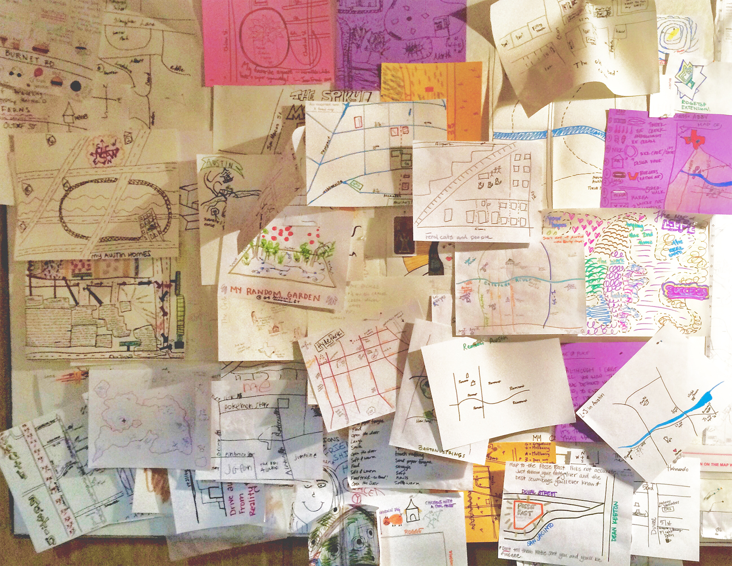
Maps collected during EAST 2014
The Atlas
Our collection of hand drawn mental maps is a crowdsourced atlas of Austin. The Atlas currently contains around 250 maps. Though some of the Maps were instigated with a specific prompt (i.e. map your most common routes), most were the result of asking people to map something they care about in the city. The resulting work covers vast territory including:favorite coffee spots, places to forage for nuts, safe places to sleep in public, memorable urban adventures, peoples neighborhoods, or romances that played out across the city. (to name a few)
View the maps that have been scanned an uploaded here. Or come to an Atlas event to see the Atlas in person.

Cover of the Urban Oddities Guide
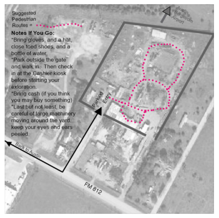
Pedestrian Guides
We believe in getting to know the city you live in via exploring and traversing it on foot (or bike). Walking for the sake of walking is wonderful in and of itself. But the Atlas pedestrian guides help add the thrill of the hunt. The guides focus on hidden and/or unsung aspects of Austin's man-made and natural environment.
More on the Guides (current and proposed) here.
Digital Urban Oddities Guide: here.

1839 plan of Austin
Aggregated Maps
We put all the Austin maps we find online in one place, and this is it.
Audio Tour Map